The Catalogue of the Ships in the Iliad
In Book 2 of Homer's Iliad, the poet lists the places from which the heroes came as they assembled at Aulis for the Trojan expedition. This page lists the contingents in the order in which they appear in the Iliad, with links on subsequent pages to videos that show what the places look like today. The videos contain no narrative, only natural sounds like wind, water and the song of birds.
In exploring and locating the sites I have been guided by the scholarship of Richard Hope Simpson in Mycenaean Greece and Homeric Tradition and Robert H. Consoli, creator of the the Mycenaean Atlas Project. These sources have essential background, commentary and bibliographies.
This list is a work-in-progress (from May 2025). It is unlikely to be finished.
Jonathan Brown
Author of Homeric sites around Troy (2017) and
In search of Homeric Ithaca (2020)
- Boeotians
- Minyans
- Phocians
- Locrians
- Abantes (Euboea)
- Athenians
- Salamis
- Kingdom of Diomedes
- Kingdom of Agamemnon
- Kingdom of Menelaus - Lacedaemonians
- Kingdom of Nestor
- Arcadia
- Epeians
- Kingdom of Meges
- Kingdom of Odysseus
- Aetolians
- Cretans
- Rhodians
- Kingdom of Nireus
- Kingdom of Pheidippus and Antiphus
- Kingdom of Peleus and Achilles
- Kingdom of Protesilaus
- Kingdom of Eumelus
- Kingdom of Philoctetes
- Asklepiadai
- Kingdom of Eurypylus
- Kingdom of Polypoetes
- Kingdom of Gouneus
- Kingdom of Prothous
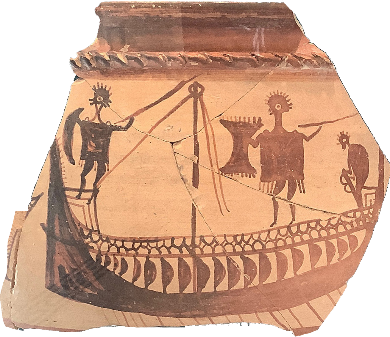
Part of a pictorial crater with sea-battle scene, 12th century B.C., found at Cynus (Kynos), Archaeological Collection of Atalanti, Phthiotis, Greece. Photo by the author.